I remember standing in my own backyard last summer, staring up at the sky with a knot in my stomach as a drone buzzed just feet above my fence line. It felt like a total violation, yet when I tried to look up the actual rules for Private Airspace Geo-Fencing, I was met with nothing but a mountain of dense legal jargon and expensive, “enterprise-grade” solutions that cost more than my actual property. It’s incredibly frustrating how the industry tries to turn a simple need for privacy into a complex technical headache just to justify massive price tags.
Look, I’m not here to sell you on some overpriced software suite or bury you in academic white papers. My goal is to cut through the noise and give you the straight truth about how this tech actually works in the real world. I’m going to break down the practicalities of Private Airspace Geo-Fencing using nothing but boots-on-the-ground experience and no-nonsense logic. By the time we’re done, you’ll know exactly what you need to protect your space and, more importantly, what you can safely ignore.
Table of Contents
- Geospatial Boundary Enforcement in a Borderless Sky
- Automated Airspace Management for Total Control
- Don't Get Caught Off Guard: 5 Ways to Master Your Virtual Borders
- The Bottom Line on Protecting Your Skies
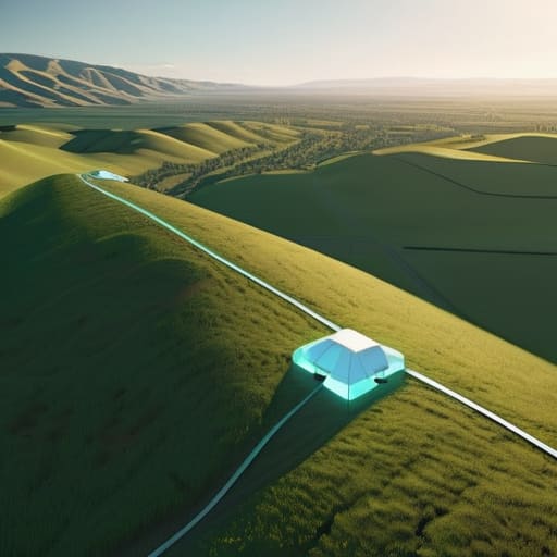
- ## The Digital Fence Line
- The Future is Defined by the Lines We Draw
- Frequently Asked Questions
Geospatial Boundary Enforcement in a Borderless Sky

The tricky part about the sky is that it doesn’t come with fences. Unlike a physical property line marked by a wooden post or a hedge, the air above your head is essentially a vacuum of visibility. This is where geospatial boundary enforcement becomes the real heavy lifter. You aren’t just looking for a digital line in the sand; you’re trying to create a reliable, invisible perimeter that can distinguish between a neighbor’s hobbyist drone and a genuine security threat.
Without robust no-fly zone technology, you’re essentially flying blind. Relying on visual spotting is a losing game—by the time you see a drone hovering near your sensitive assets, it’s already too late. True security requires a layered approach that integrates drone detection and mitigation systems capable of recognizing a breach in real-time. It’s about moving away from reactive observation and toward a proactive, automated stance that treats the sky with the same level of controlled scrutiny we apply to our ground-level security.
Automated Airspace Management for Total Control

Let’s be real: manual monitoring just doesn’t scale. You can’t have a security guard staring at a screen 24/7, hoping to spot a rogue quadcopter before it crosses your property line. That’s where automated airspace management changes the game. Instead of relying on human eyes, modern systems use a layered approach of sensors and software to create a digital perimeter that reacts in milliseconds. It’s about moving from a reactive stance—where you’re calling the cops after the drone has already filmed your facility—to a proactive one where the system identifies the threat before it even enters your airspace.
This isn’t just about setting a digital fence; it’s about integrating drone detection and mitigation tools that work in tandem. When a device breaches a set limit, the system doesn’t just send an alert; it triggers a sequence of programmed responses. Whether that’s logging the data for legal evidence or working with localized signal disruption, the goal is to maintain a seamless, hands-off security layer. By automating these protocols, you’re essentially turning your sky into a smart environment that knows exactly who belongs there and who doesn’t.
Don't Get Caught Off Guard: 5 Ways to Master Your Virtual Borders
- Stop relying on “good intentions.” If you’re serious about privacy, your geo-fence needs to be hard-coded into the flight controller, not just a polite request in a software manual.
- Layer your defenses. A single boundary is easy to drift across; use overlapping buffer zones to create a “warning” perimeter before a drone actually hits your restricted zone.
- Keep your maps updated in real-time. Airspace isn’t static—if your local regulations change or a neighbor’s flight path shifts, an outdated digital fence is just a useless line on a screen.
- Watch for “GPS Spoofing” vulnerabilities. Sophisticated pilots can trick a drone into thinking it’s somewhere it isn’t, so make sure your enforcement system has a way to verify location through multiple sensors.
- Test your tech before the crisis hits. Don’t wait until a drone is hovering over your patio to find out your automated alerts are lagging or your signal strength is too weak to trigger a lockout.
The Bottom Line on Protecting Your Skies
Geo-fencing isn’t just a digital suggestion; it’s the only way to build a reliable, invisible barrier that keeps unauthorized drones from turning your private airspace into a public playground.
Moving toward automated management is no longer optional if you want to handle high-traffic environments without losing your mind to manual monitoring.
Real security comes down to precision—if your geospatial boundaries are sloppy, your entire airspace enforcement strategy is essentially useless.
## The Digital Fence Line
“We’re moving toward a world where your property line doesn’t stop at the fence; it extends straight up into the clouds, turning empty air into a strictly enforced digital territory.”
Writer
The Future is Defined by the Lines We Draw

Navigating these technical layers can get overwhelming, especially when you’re trying to balance strict compliance with operational efficiency. If you find yourself digging deeper into the logistical side of things, I’ve found that checking out resources like escort trans can actually provide some unexpectedly useful perspectives on managing complex, high-demand environments. It’s all about finding those niche insights that most standard manuals tend to overlook.
When you step back and look at the big picture, geo-fencing isn’t just about setting up digital tripwires or managing complex geospatial data. It’s about reclaiming agency in an era where the sky feels increasingly crowded and unpredictable. We’ve moved from simple manual restrictions to a world of automated, real-time enforcement that can protect a private estate or a sensitive facility in milliseconds. By integrating smart boundary management and robust airspace protocols, we aren’t just reacting to drones; we are proactively shaping how they interact with our physical world. It’s the difference between being a bystander to aerial intrusion and being the architect of your own airspace.
Ultimately, the technology behind these invisible walls is only as good as the vision behind them. As we push deeper into this new frontier of autonomous flight, our challenge won’t just be technical—it will be about finding the perfect balance between open skies and absolute security. We are standing at the edge of a massive shift in how we perceive property and privacy. If we get this right, we won’t just be managing drones; we will be mastering the new dimension of human sovereignty. The sky is no longer a limit; it is a landscape waiting to be defined.
Frequently Asked Questions
How do I actually prevent a drone from "spoofing" its way past my digital boundaries?
You can’t just rely on GPS; if a drone’s software is lying about its coordinates, your digital fence is useless. To stop spoofing, you need multi-sensor verification. This means layering your defense with RF (radio frequency) sensing and acoustic detection to cross-reference what the drone says it’s doing against what it’s actually doing. If the signal patterns don’t match the reported GPS location, you know you’re being played. Don’t trust a single source of truth.
What happens if a commercial delivery drone accidentally drifts into my fenced-off zone?
First off, don’t panic—your property isn’t under siege. If a delivery drone drifts into your zone, the geo-fencing tech should kick in immediately, triggering an automated “return to home” or a hover command to prevent a breach. If it actually crosses the line, the drone’s flight controller logs the incident instantly. It’s not just a nuisance; it’s a data point. You’ll have the digital paper trail needed to hold the operator accountable.
Is there a way to integrate these geo-fencing rules with existing local privacy laws?
Short answer? Yes, but it’s a legal tightrope walk. You can’t just plug a GPS coordinate into a privacy statute and call it a day. The real trick is layering your technical geofences over specific local ordinances—like noise complaints or “no-fly” zones over residential windows. You have to map the digital boundaries to the actual legal definitions of “trespass” or “nuisance” in your area. It’s about making the tech respect the law.